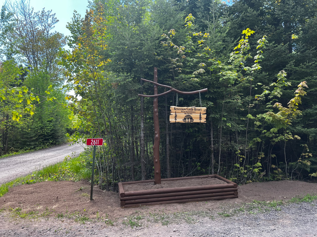
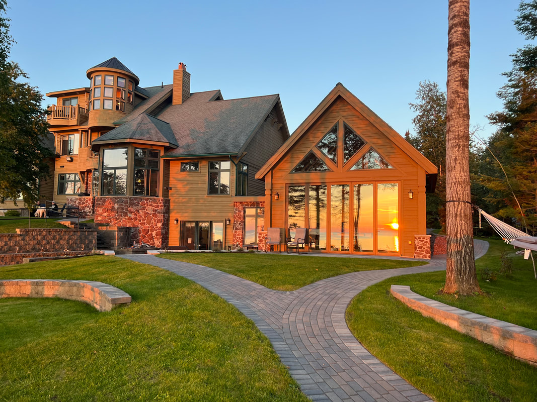
Keweenaw Castle Resort 2611 Seven Mile Point Road Allouez, MI 49805 Click here for Google Map Click here for iPhone Map
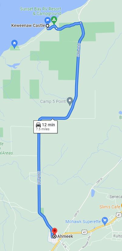
General Directions: Use "Keweenaw Castle" in your map program for best results. We are also next door to the Sunset Bay Beach Campground. 1. Starting from the Portage Lift Bridge (located in Michigan's Upper Peninsula between Houghton/Hancock), we are 30 minutes North. 2. Follow US 41N until you reach Ahmeek, MI.
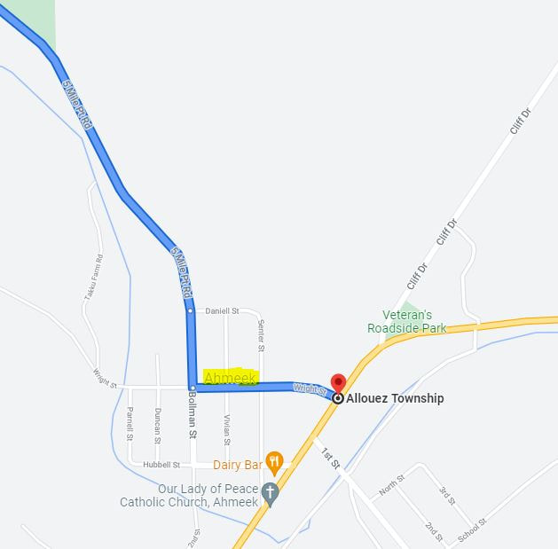
3. Turn Left on Wright Street (Sign on US41 indicating to turn take the next left to get to 5 Mile Point Rd/no road sign/see map for name) and go three blocks in. 4. Turn Right at the stop sign onto Bollman Street which turns into 5 Mile Point Rd (again/no road sign). 5. In approximately 12 minutes, Sunset Bay Beach Road will be on your left (dirt road/mailboxes on left). Sunset Bay will turn into Seven Mile Point Rd (just a right angle/campground entrance would go straight). 6. Drive a total of one mile on the dirt road (view the scenic one-mile wood-scape). We will be on the right just past the campground entrance (Fire Number 2611).
Play by Play Directions US HWY 41 actually begins at the tip of the Keweenaw Peninsula (go take a pic at the sign!). Follow US HWY 41 N to the Portage Lift Bridge (huge icon for this area). From there, we are 30 minutes north. Approximately 15 minutes into your drive up, you will reach historic Calumet. It is also the home of a private club in which we are members, the closest large grocery store, and the only place in the Keweenaw that you will find fast food. Pass straight through and in another 10 minutes you will enter Keweenaw County/Allouez Michigan. Once you reach Ahmeek, there will be a sign directing you to turn Left to reach Five Mile Point Road (called Wright Street if using a map). The third street in is called Bollman Street, turn Right here. Bollman turns into Five Mile Point Road. Stay on Five Mile for approximately 10 minutes and you will be at the top of Red Rock Hill (in the daylight you will have a panoramic view of Lake Superior from here). Down the hill and around two corners, the road will straighten (~2 more miles) and Sunset Bay Beach Road (which turns into 7 Mile Point Road) will be on your left. This is a dirt road with mailboxes on the left and signs for a campground in the summer. We are one mile in on the right. We are part of a private rural community (7 Mile Point Community) so signage is minimal.